The High Country and Snowy Mountains regions of both Victoria and New South Wales offer stunning scenery and numerous options for camping, ranging from caravan parks to secluded sites tucked (hopefully) away from the maddening crowd.
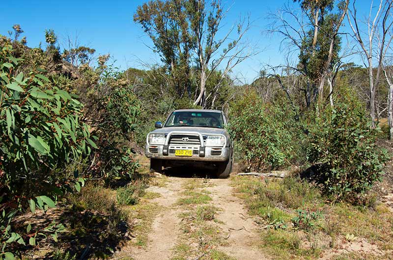
East of Melbourne, along the Princes Highway, there are a number of opportunities to catapult your way north along roads that provide a wild ride up into the Great Dividing Range. Because of the endless hairpin turns, and frequent unsealed sections of road, these opportunities are best tackled with a 4WD and all-terrain camper trailer or tent. For up-to-date conditions, check with one of the information centres in Sale, Bairnsdale or Lakes Entrance, depending on which road you want to tackle.
TAKING THE BARRY WAY
One of the most interesting routes climbs beside Victoria’s Snowy River National Park, and at the New South Wales border, along the southern boundary of Kosciuszko National Park, it becomes the Barry Way, continuing on to Jindabyne. It is what you see along the way that makes this such an attractive option.
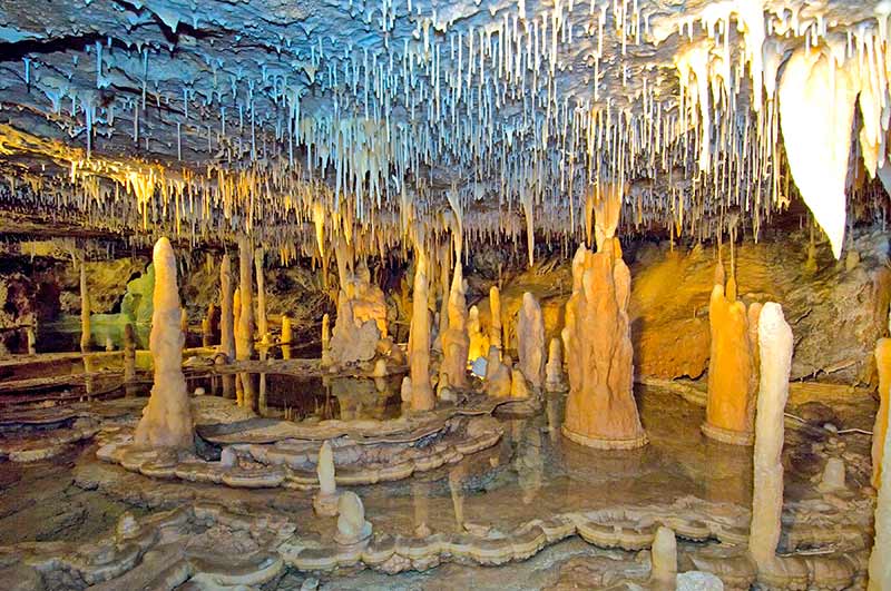
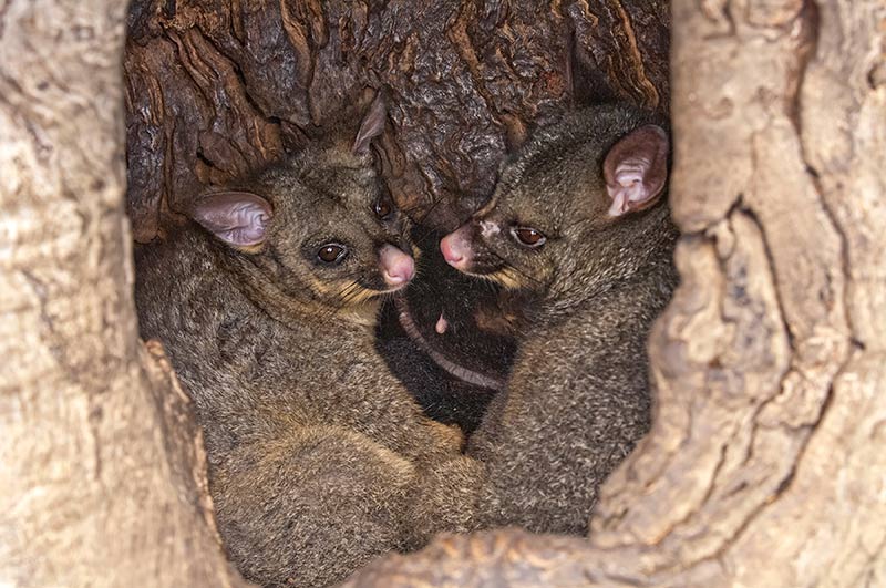
You can access the start of this trip along Bruthen-Buchan Road, either from Bruthen or Nowa Nowa. Things are fairly mundane until you reach Buchan Caves Reserve, which is worthy of a stay. The campground is excellent, with plenty of wildlife and birdlife, and a guided tour of Fairy Cave or Royal Cave reveals a wonderland of decorations. (Please note that the reserve is undergoing construction to repair the extensive damage caused by the bushfires of 2019-2020; this should be completed by the end of 2022. Check here for more information). If you need fuel, Buchan is the place to get it.
After Buchan, C608 becomes Gelantipy Road. Shortly, the terrain and the scenery become interesting. The road is tucked between Snowy River NP to the east and a series of nature conservation reserves to the west. As you climb, expect plenty of sharp turns.
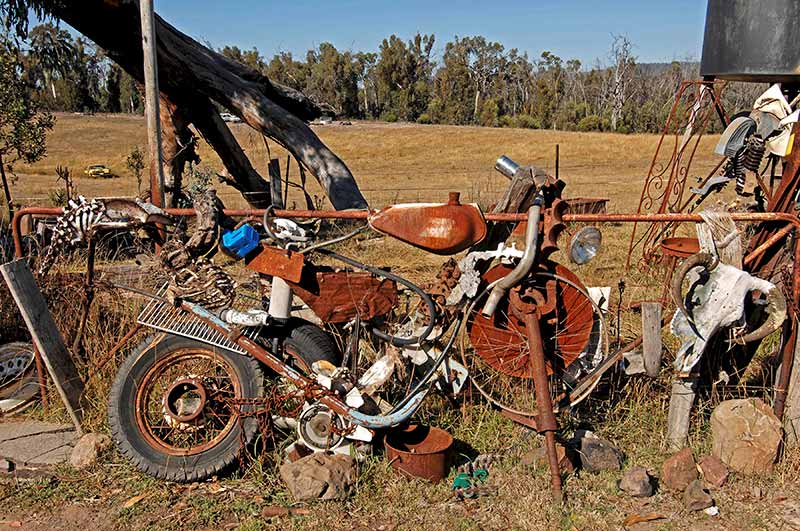
Unexpectedly, you might notice SIBA, a Buddhist Retreat Centre (with camping). The road straightens out a bit from SIBA to Gelantipy, a tiny rural community that was heavily, and tragically, impacted by the 2019-2020 fires. The Seldom Seen Roadhouse was once the only fuel stop between Buchan and Jindabyne, but it is no more, and its funky collection of ‘stuff’ is only a memory. It was one of those ‘fair dinkum’ spots that added a bit of curiosity and fun to the drive.
At Gelantipy, C608 becomes Snowy River Road. At the junction of C611, experienced four-wheel-drivers without anything in tow might want to take a 55km (return) side trip to McKillops Bridge. There are a couple of lookouts along the way and a basic campground. This is considered one of the most dangerous roads in Australia, so take heed if you decide to attempt it.
Snowy River NP is still to the east, to the west is Alpine National Park. Within 10km, the road becomes unsealed, narrows and begins an endless parade of hairpin turns. Suggan Buggan provides a camping and rest area with tables; from here the road continues its crazed ascent with not-very-reassuring vertical, unfenced drop-offs.
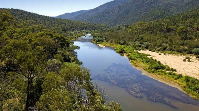
Within 10km, the Snowy River appears and you continue to follow it to the border, with the Willis Campground being the last stop on the Victoria side. Over the border, you are now in New South Wales’ Kosciuszko NP and on the Barry Way; the Willis picnic area is also on the New South Wales side.
CAMPGROUND HIGHLIGHT
From here, four campgrounds are on offer right next to the Snowy River. Frankly, this is the highlight of the entire drive. Each campground offers tent sites, toilets, a picnic table and wood barbecue facilities. Who wouldn’t want to camp beside the Snowy River with the chance to do a bit of swimming, fishing, kayaking or canoeing? To just sit by the water and read a book is a worthy pursuit.
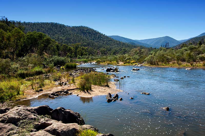
Running Waters and Pinch River are both outstanding bush camps, as is Halfway Flat where the Snowy River bends to the west. Jacobs River campground is last, not surprisingly it is beside Jacobs River. Jacks Lookout provides a perfect view of the Snowy River snaking into the distance; the No Name picnic area sits right beside that iconic waterway.
Mountain bikers and walkers might want to venture along a short portion of the Pilot Wilderness Mountain Bike Trail which ends at the Pinch River Campground. This entire area is a place that forces you to relax and enjoy the surroundings without all those modern inconveniences that gobble up your time and attention at home. With no phone reception and internet to distract you, you will soon find that nature is far more soothing to the soul.
CONTINUING ON THE BARRY WAY
After spending as much time as possible here, continue on as the Barry Way staggers north like an intoxicated snake. This was once an important trading route for the Walgal people and then became a stock route for driving cattle from the Alps down through to Bairnsdale.
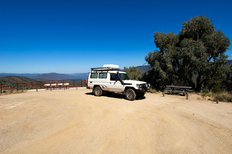
Judging by the terrain, the construction of the road was a feat of engineering. You are still climbing through a series of twists and turns etched in green, and to truly appreciate the landscape you have just driven through, it is essential to stop at the Wallace Craigie Lookout. Here, you can look back at the journey, and in a way, back in time. Standing up above the vast, formidable Pilot Wilderness and Byadbo Wilderness areas is cause for awe, and the lookout provides a picnic table where you can have a scenic lunch you won’t soon forget.
From here, you leave the boundary of the national park. It isn’t far before you see a sign on the west side of the Barry Way for Snowy Wilderness Resort. This is a magical property offering unique accommodation, 4WD tagalong tours and horse-riding tours.
By now, more and more of the land is cleared, and nothing illustrates the need to conserve natural environments more than the contrast between where you have just been and where you are now going.
From the rural town of Ingebirah the road becomes sealed with another 30km to Jindabyne with the very pretty Lake Jindabyne, created by the Jindabyne Dam. The NRMA has a caravan park here; there is also a Discovery Park. The Snowy River Visitor Centre will provide you with all the information you will need.
And what is beyond the Barry Way? Well, that is for you to discover, but a good beginning would be the Alpine Way wandering through Kosciuszko NP. At least that way, you can put off getting back to the ‘real world’ for just a little bit longer.
Images: Steven David Miller / Natural Wanders
FAST FACTS
With a total distance of about 250km, it is wise to fuel up either in Bairnsdale or Jindabyne. There is fuel at Buchan.
Fire ban days must be strictly observed. For information, check the NSW Rural Fire Service and Victoria’s Country Fire Authority.
Before the drive, check road conditions and warnings for both Victoria and New South Wales.
Kosciuszko NP does not require a park permit to travel along the Barry Way. Other parts of the park do require a pass.
Kosciuszko NP is in the process of requiring a booking for all camp sites. The sites along the Barry Way are free, but a booking fee is required.
If you want to have a go at fishing in the Snowy River, a NSW fishing license is required.
Visitor guides and brochures:
- Kosciuszko NP scenic drives. Kosciuszko NP Lower Snowy River Area and Brochure
- Alpine National Park
- Snowy River NP Visitor Guide


